
Use of Technology in the Land & Water Conservation Department
Geographic Information Systems (GIS), Global Positioning Systems (GPS), and Computer Aided Design (CAD) are three components of the suite of tools our technicians utilize on a daily basis to design conservation practices to improve environmental quality in Winnebago County. We strive to be on the forefront of employing technology to improve efficiency and effectiveness in our work.
We added an Unmanned Aerial Vehicle (UAV) to the department in 2018. The UAV or drone is used to capture aerial photos and video of existing conditions, construction progress, and mapping data. This powerful tool will allow for better communication, high resolution mapping, and improved project monitoring. The department has 2 FAA Certified Part 107 Pilots and maintains strict operating procedures.
Geographic Information System (GIS)
GIS is computer software that allows us to graphically represent various data layers. Our department has had GIS capabilities since 1995. We have recently improved web mapping capabilities to include creating mobile based apps for data collection in the field. GIS Maps for public use are available on the Planning & Zoning Department's site.
What is a GIS?
A Geographic Information System, or GIS, is an organized collection of computer hardware, software, geographic data, and personnel designed to efficiently capture, store, update, manipulate, analyze, and display all forms of geographically referenced information. Or, in simple terms:
A computer system capable of holding and using data describing places on the earth's surface.
Many computer programs, such as spreadsheets, statistics packages or drafting packages can handle simple geographic or spatial data, but this does not necessarily make them a GIS. A true GIS links spatial data with geographic information about a particular feature on the map. For example, the outline that represents an agricultural field on a map doesn't tell you much about the field except its location. To find out the field's acreage or crop type, you must query the database. Using the information stored in the database, you could create a display symbolizing the agricultural fields according to the type of information that needs to be shown.
In short, a GIS doesn't hold maps or pictures - it holds a database. The database concept is central to a GIS and is the main difference between a GIS and drafting or computer mapping systems, which can only produce a good graphic output. All contemporary geographic information systems incorporate a database management system.
GIS is not......
.....simply a computer system for making maps, although it can create maps at different scales, in different projections, and with different colors. A GIS is an analytical tool. The major advantage of a GIS is that it allows you to identify the spatial relationship between map features. A GIS does not store a map in any conventional sense; nor does it store a particular image or view of a geographic area. Instead, a GIS stores the data from which you can draw a desired view to suit a particular purpose.
For more information and free GIS software follow the links below:
- http://www.esri.com/software/arcgis/explorer
- http://www.esri.com/software/arcgis/arcgisonline/features/free-personal-account
- http://www.qgis.org/en/site/
Global Positioning System (GPS)
 In 2001, our department purchased a Trimble unit that is capable of sub-centimeter accuracy. It utilizes satellites that determine latitude and longitude as well as the elevation of any site within the county. In 2018, the department acquired 2 new GPS units that will allow our department to double our survey capability, reducing time and improving service!
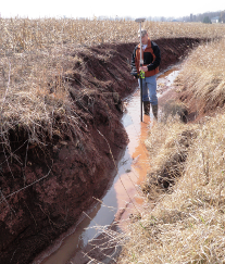
GPS or Global Positioning System refers to technology that utilizes satellites to determine the location of points on the earth's surface. In 2001, our department purchased a Trimble GPS unit that not only measures latitude and longitude, but also calculates the elevation with sub-centimeter accuracy. This is an extremely accurate and useful tool for many applications within our department. Large topographic surveys can now be completed in a single day. Completing such surveys with conventional surveying equipment may have taken a week.
Use of GPS Unit
Since purchasing the Trimble GPS unit in 2001, our department uses GPS on nearly every construction project. Having access to the WISCORS network provides real time corrected GPS signal acquisition ensuring sub-centimeter accuracy. A few examples of work completed with GPS are:
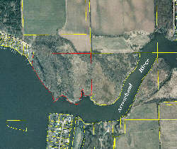
- Survey of Terrell's Island Vegetation.
- Bathymetric Survey on Rush Lake.
- Survey of Lone Willow Island Marsh breakwall.
- Shoreline and Streambank Erosion Survey in Pool Lakes.
- Culvert Surveys in Neenah, Clayton, and Black Wolf Townships.
LiDAR (Light Detection and Ranging)
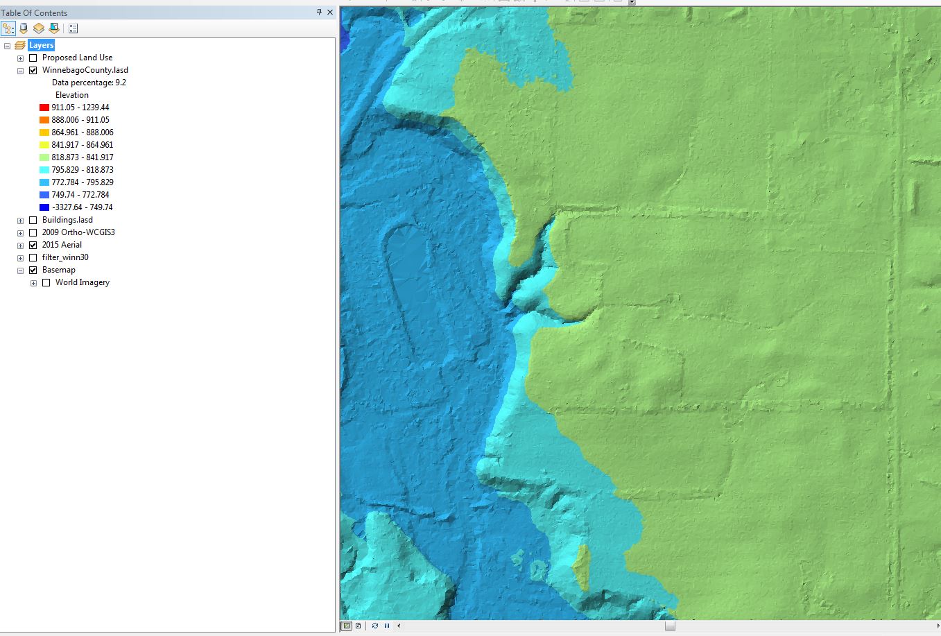
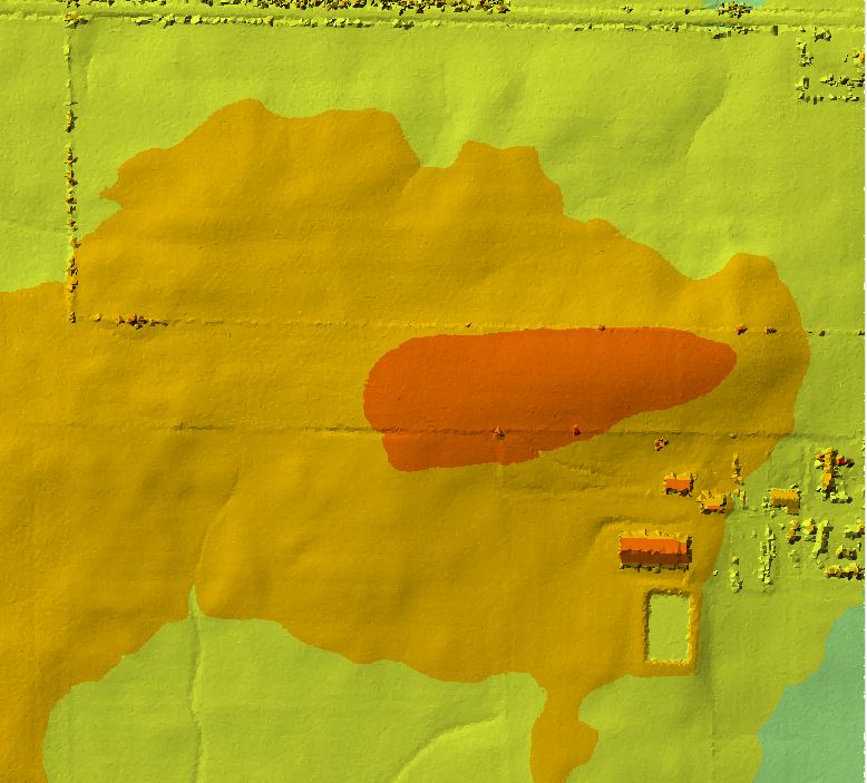 LiDAR is very high resolution data that allows for 3-D modeling of the landscape. In 2017 Winnebago County received its first LiDAR data. We use the LiDAR data to model elevations, thereby providing technicians with the ability to design projects with highly accurate elevations. Other products include creating 3D maps classifying, trees, water, and building footprints creating powerful visualization tools.
LiDAR or Light detection and ranging is remote sensing technology that captures extremely high resolution data. LiDAR can be captured for many different applications from 3D building models to more common topographic land survey. Winnebago County acquired its first LiDAR data in 2018 and has been using the high resolution elevation data to create more accurate engineering designs. The ability to create highly accurate designs in the office helps to speed design time by limiting the amount of time spent in the field gathering data. While LiDAR data will never replace doing field surveys, it has allowed us to be more efficient in the time spent in the great outdoors!
You have free access to download LiDAR data here
Some examples of LiDAR data being displayed are below:
Computer Aided Design (CAD)
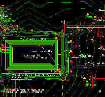
This is computer software that allows our technicians to produce high quality designs for various conservation practices. It allows us to integrate GIS data layers and elevation data from our GPS unit.
CAD or Computer Aided Design refers to software that allows our technicians to design Best Management Practices in a computerized format. In the past, design work was done primarily by hand with a pencil. There are many advantages of a design done in a computerized format. One of the biggest advantages is that changes can be made quickly and easily. Another advantage is that CAD allows us to integrate data from our GPS and GIS.
Integration with GPS/GIS
One of the most important benefits of CAD is that the data can be integrated from our GIS and GPS equipment for various applications. Topographic data from the GPS unit can be downloaded and integrated into CAD for designing any Best Management Practice. GIS data layers can be added to create a map that shows the location and elevations of such features as farm buildings, drainage ditches, culverts, or rock breakwalls.
Unmanned Aerial Vehicle (UAV/Drone)
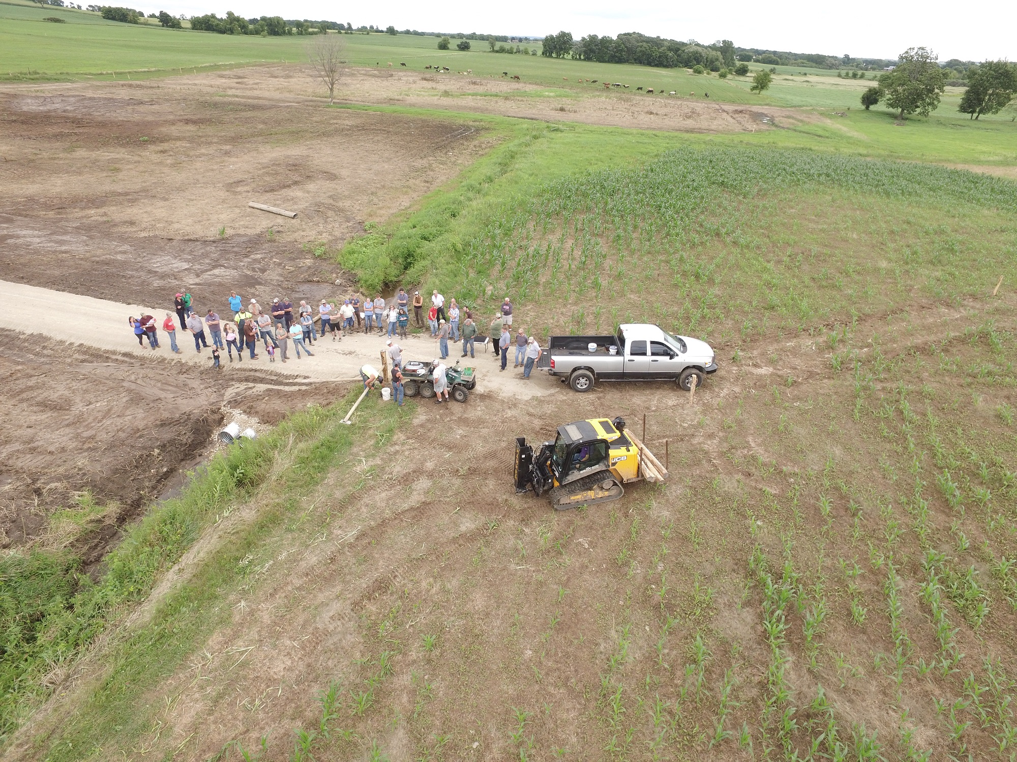
Winnebago County LWCD has the first official drone program in the County! We utilize our UAV affectionately known as "Blinky" to capture a variety of images and video. Our two FAA Certified pilots can capture simple oblique photographs to mapping entire fields or project sites. The UAV can capture important construction photos simply not possible with a standard camera.
Examples of videos created with our drone:
These are a few samples of video taken with our UAV. We also use the drone to capture aerial photos that are then processed to create actual othrophotos that can be viewed in a GIS. This provides us the ability to conduct change detection analysis without having to wait several years for an entire county aerial flyover.