
Best Management Practices (BMPs) in Winnebago County
Best Management Practices (BMPs) are proven conservation methods used to protect natural resources—particularly soil health and water quality. These practices are essential for managing our lakes, supporting sustainable agriculture, and reducing nonpoint source pollution such as phosphorous and sediment runoff.
How We Help
The LWCD administers federal, state and county programs that provide technical assistance and cost-sharing opportunities to help landowners and farmers install BMPs. These programs help address specific water quality issues while making conservation easier and more affordable for landowners.
Interested in cost-sharing for a conservation practice? Complete our general APPLICATION FORM to get started.
Conservation Practices We Support
Below are some of the key conservation practices eligible for technical assistance and cost-sharing in Winnebago County:
Soil health practices |
|---|
|
Nutrient Management Plan (NMP)
In Wisconsin, all farms should have a nutrient management plan. Some farms will follow a nutrient management plan if they:
The Winnebago County LWCD provides cost-sharing and technical assistance for Nutrient Management Planning. Please contact us for more information. Resources:
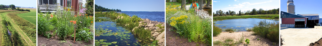
Photo: Crops need Nitrogen (N), Phosphorus (P) and Potassium (K) |
 No-Till
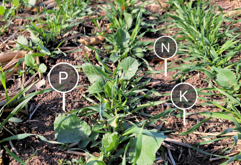 A NMP is a yearly plan that helps farmers apply the right amount of fertilizer and manure to their crops. It starts with soil testing to see what nutrients are already in the ground. This helps the farmer figure out how much more is needed for each crop. In Wisconsin, farmers use a software tool called SnapPlus to create their plans. It also helps show where soil or phosphorus might be lost, so farmers can adjust things like tilling or crop rotation to reduce that loss. The goal is to grow healthy crops while protecting the environment by giving plants the right nutrients, in the right amount, at the right time, and in the right place.
Structural practices |
|---|
 Barnyard Runoff Control SystemThe use of structural measures such as gutters, downspouts and diversions to intercept and redirect surface runoff around the barnyard, feeding area or farmstead, and collect, convey and temporarily store runoff from the barnyard, feeding area or farmstead. |
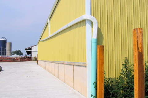
 Manure Storage SystemA manure storage system is an impoundment made by constructing an embankment, excavating a pit or dugout, or by fabricating a structure to temporarily contain manure and other animal or agricultural wastes. These systems protect water quality by preventing runoff from animal lots, cutting fertilizer costs and preventing nutrient losses in agricultural fields, and allowing for manure to be safely stockpiled until conditions are environmentally safe for spreading. |
|
Streambank and Shoreline ProtectionVegetation, rock, or structures used to stabilize and protect the banks of streams, lakes, estuaries or excavated channels against scour and erosion and reduce sediment delivery to the water body. 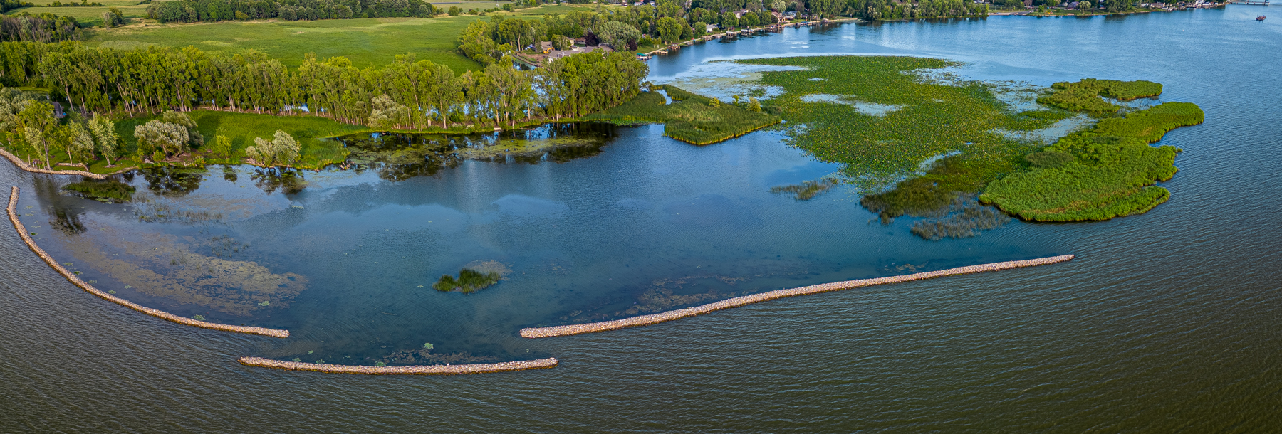 Photo: Stabenow Breakwall, Credit: Tim McEnroe, August 2023 Since 1941, the damage done at the Stabenow site by high water, waves, and ice has resulted in an average lateral recession of up to 2.5 feet of wetland per year, resulting in increased turbidity and loss of fish and wildlife habitat. Off-shore breakwalls were designed by the Winnebago County Land & Water Conservation Department (LWCD) and installed by local contractors to reduce sediment re-suspension within the habitat restoration area by reducing wave size and protecting the shoreline of the emergent marsh from further erosion. To determine the efficacy of the breakwall structures, the LWCD has been monitoring to determine the regrowth of aquatic plants, both emergent and submergent species. The aquatic plant monitoring comparison from 2021 to 2023 at the site has shown an overall impressive plant response in greater densities and species diversity. |
Waterway SystemA natural or constructed drainageway or channel shaped, graded and established in suitable cover as needed to prevent erosion by runoff waters. |
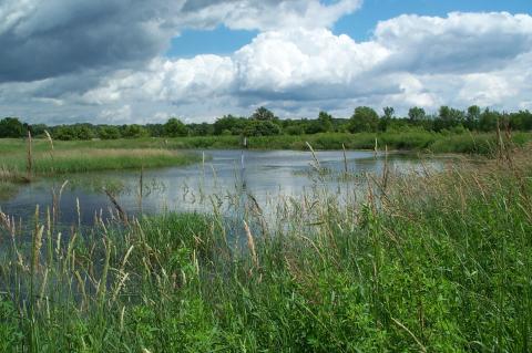
Wetland RestorationWhat is a Wetland Restoration? Wetland Restorations are incredibly effective conservation practices because of the multifunctional values they provide. They protect water quality by removing sediment and nutrients from runoff AND provide habitat for a multitude of wildlife. Restorations may include construction of berms, excavation for ponds or the destruction of tile line or drainage ditch functions to create conditions suitable for wetland vegetation. Click to enlarge example photos below.
Wetland Restoration Demonstration at the James P Coughlin Center |
 Shoreline Habitat Restoration (SHRUB)
other conservation practices |
|---|
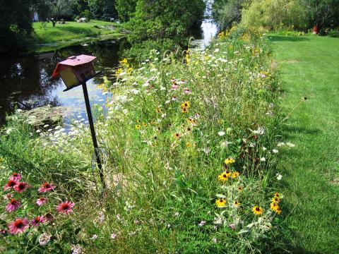
Rain GardensWhat is a Rain Garden? Rain gardens are landscaped areas planted with wild flowers and other native vegetation that soak up rain water from the roof of a house or other building. After a storm, the rain garden fills up with a few inches of water and slowly infiltrates into the soil. This reduces the amount of water running off the ground and into a storm drain. A rain garden allows about 30% more water to soak into the ground than a conventional lawn. Why are Rain Gardens Important?
James P Coughlin Center Rain Garden Tour Installed in 2018, the Rain Garden takes drainage from about 6,000 square feet of the Coughlin Center's roof. During a 1 inch rainfall, this is 3,700 gallons of rain water. Rain Gardens are designed to keep rainwater, and the pollution it may carry, from eventually flowing into Lake Winnebago. Plus, they are beautiful gardens with a variety of plants that attract and provide a healthy habitat for birds, bees and butterflies! With roots growing down twice as deep as the plants are tall, the NATIVE PLANTS used in this garden are great at soaking up water.
|
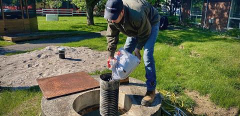
Well Abandonment
Abandoned or unused wells pose a great threat to the safety and quality of groundwater drinking water supplies. An unused well provides a direct path for contaminants and pollutants to the underground aquifers that supply working wells. Once contaminants reach the groundwater, it is difficult, if not impossible to remove them. Old and unused wells may also pose a safety hazard. Dug wells can be 6 feet across and 50 feet deep or deeper. Serious injury or worse could result if a person or animal fell into an old well. Wells must be properly filled and sealed when they are no longer in use or fail to meet the State Well Code (NR812) standards.
How Do I Get Started?
|
 Why Should I Properly Abandon My Old Well?