
Use of Technology in the Land & Water Conservation Department
We use the latest technology to make our work more efficient and effective. Our team regularly works with tools like Geographic Information Systems (GIS), Global Positioning Systems (GPS), and Computer-Aided Design (CAD) to plan and design conservation practices (called Best Management Practices or BMPs) that help protect the natural resources of Winnebago County.
In 2018, we added a drone (also called an Unmanned Aerial Vehicle or UAV) to our toolkit. The drone captures high-quality aerial photos and videos that show project sites before, during, and after construction. This gives us clear visuals to help monitor progress, document results, and share our work with the public.
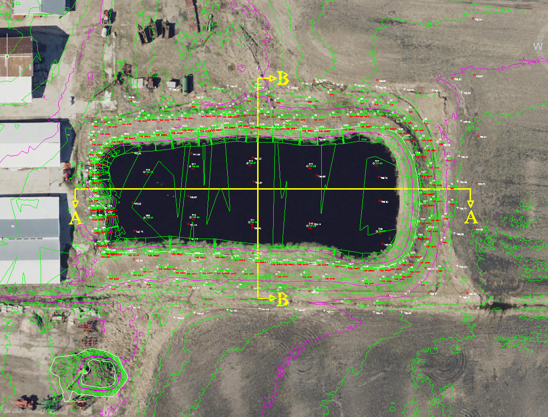 Computer Aided Design (CAD)
CAD or Computer Aided Design refers to software that allows our technicians to design Best Management Practices in a digital format. In the past, design work was done by hand with paper and pencil. One of the biggest advantages of CAD is that changes can be made quickly and easily with the click of a mouse. Another advantage is that CAD allows us to integrate data from our GPS and GIS.
Latitude, longitude, and elevation data from the GPS unit can be downloaded and integrated into CAD for designing. GIS data layers such as farm buildings, drainage ditches, culverts, or rock breakwalls can be added to create a more accurate map showing location and elevations of these features.
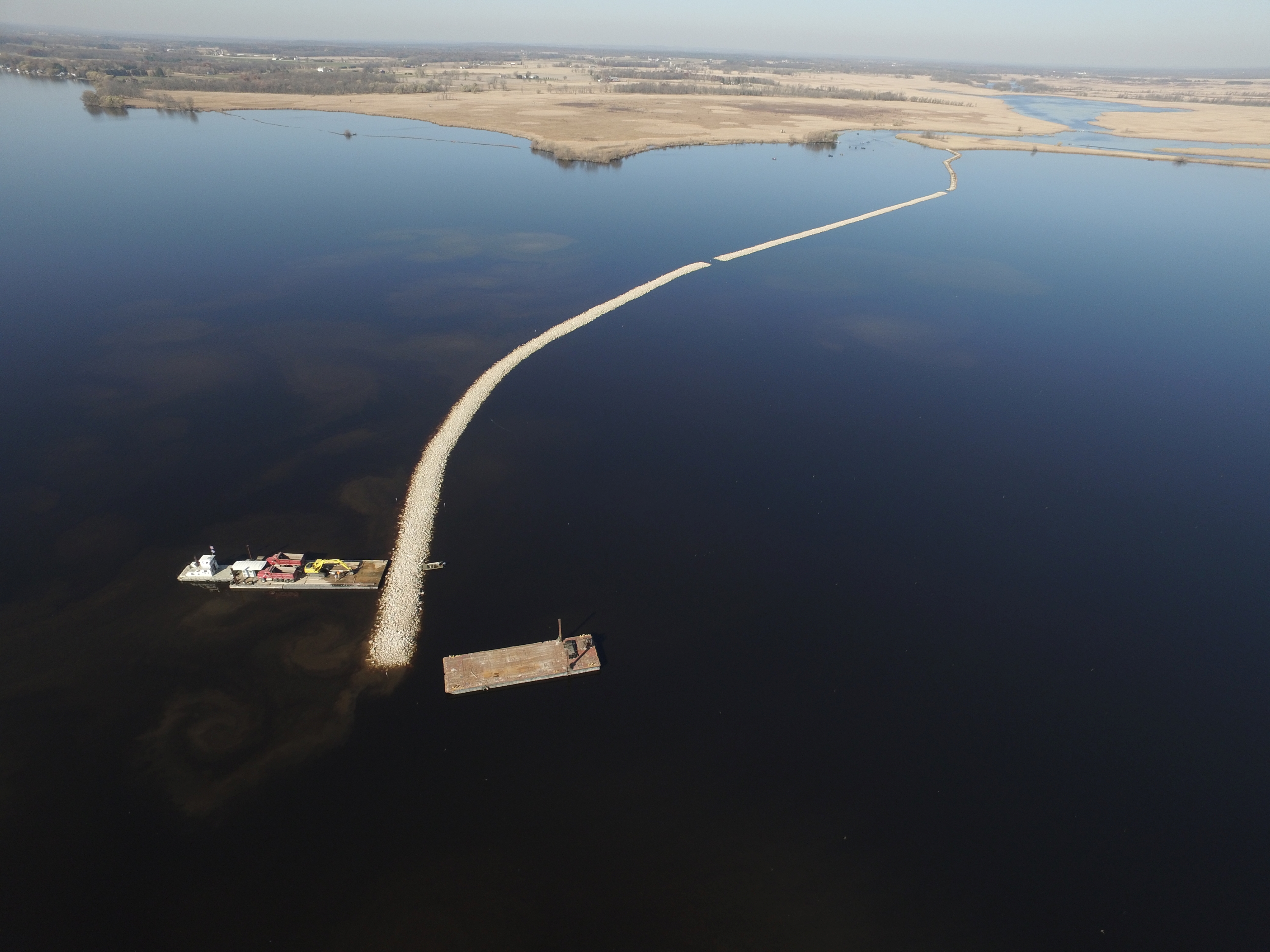 Drone (Unmanned Aerial Vehicle - UAV)
The LWCD utilizes our UAV to capture a variety of images and video. Our two FAA Certified pilots can capture simple oblique photographs or map entire field project sites. The UAV can capture important construction photos simply not possible with a standard camera.
We also use the drone to capture aerial photos that are then processed to create orthophotos that can be viewed in a GIS. This improves change detection analysis by not having to wait several years for an entire county aerial flyover.
These are a few samples of video taken with our UAV:
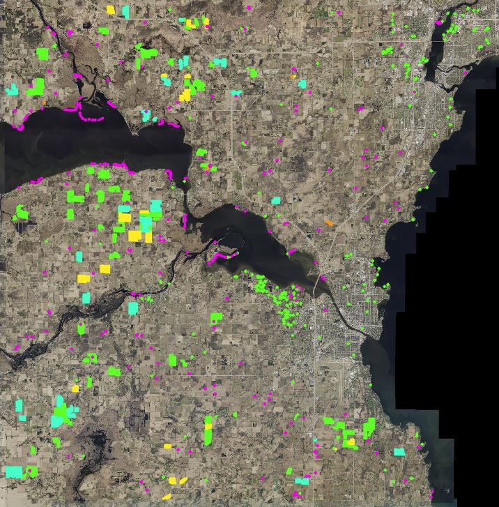 Geographic Information System (GIS)
GIS is a technology that is used to create, manage, analyze, and map all types of data. GIS connects data to a map, integrating location data (where things are) with all types of descriptive information (what things are like there). This provides a foundation for mapping and analysis that is used in science and almost every industry. GIS helps users understand patterns, relationships, and geographic context. The benefits include improved communication, management, efficiency, and decision-making.
Our department has had GIS capabilities since 1995. Recently, improved web mapping capabilities have been added to include creating mobile based apps for data collection in the field.
This photo is an example of how we use GIS to track the locations and status of Best Management Practices (BMPs) throughout the county. This BMP tracking database also includes information about inspection requirements, installation dates, BMP type or size, watershed locations, phosphorus and sediment reductions and funding information that could all be displayed spatially and used for improved analysis and visual representation of conservation efforts in Winnebago County.
GIS Maps for public use are available on the Planning & Zoning Department's site.
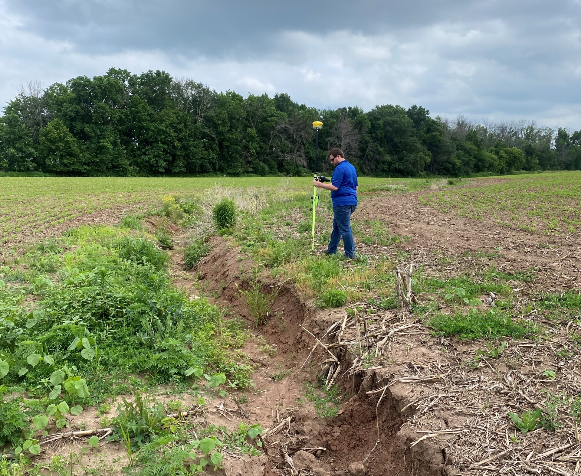
Global Positioning System (GPS)
GPS technology utilizes satellites to determine precise locations on the Earth's surface. Our department began incorporating GPS technology in 2001 with the purchase of a GPS unit, capable of measuring latitude, longitude, and elevation with sub-centimeter accuracy. Combined with access to the WISCORS network this provides real-time signal correction, ensuring high-precision results.
Since then, GPS has become an essential tool in nearly all of our construction projects. In 2018, we expanded our capabilities by acquiring two new GPS units, allowing us to double our surveying capacity. This upgrade significantly reduced survey time and improved efficiency—large topographic surveys that previously took a week with conventional equipment can now be completed in a single day.
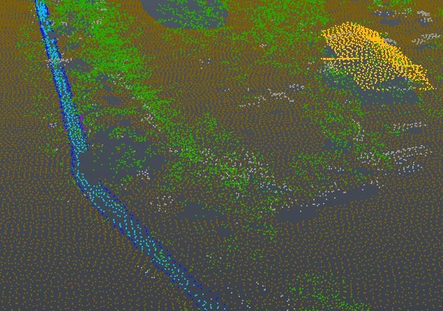 LiDAR (Light Detection and Ranging)
LiDAR is remote sensing technology that captures extremely high resolution elevation data. LiDAR can be used for many different applications from 3D building models to more common topographic land surveys. Winnebago County acquired its first LiDAR data in 2018 and has been using the high resolution elevation data to create more accurate engineering designs. The ability to create highly accurate designs from the office helps to speed up design time. While LiDAR data will never replace doing field surveys, it has allowed us to be more efficient in the time spent collecting data in the field.
This photo shows what the LiDAR elevation data looks like from ground level (brown/grey), to water level (blue), to rooftops (yellow) and up to the tree canopy (green). Every dot is an individual elevation measurement taken and compiled by LiDAR.